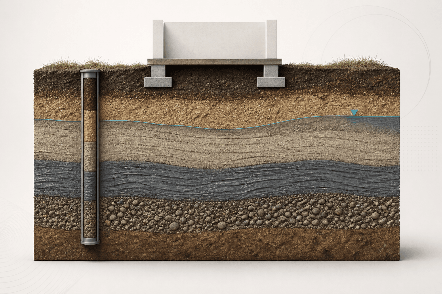
After this chapter, you should be able to
- Explain how a desk study, walkover and investigation combine into a ground model.
- Distinguish factual records, interpreted strata and design assumptions.
- Select investigation methods in response to hazards and data gaps.
- Calculate sample recovery and rock quality designation with stated conventions.
- Define hold points for updating the model during construction.
Engineering context and evidenceSource §Lesson 01 · Engineering context and evidence · NHI-16-072 Chapters 2–6 · NHI-06-088 Chapter 3
Geotechnical design begins with a model of the ground, not with a foundation equation. The model connects geology, geomorphology, groundwater, human alteration, investigation records and construction observations. It should expose uncertainty and plausible variability instead of presenting a single borehole as representative of an entire site.
Core principles and terminologySource §Lesson 01 · Core principles and terminology · NHI-16-072 Chapters 2–6 · NHI-06-088 Chapter 3
A useful investigation is iterative. Early evidence frames credible hazards; targeted fieldwork and tests reduce the uncertainties that matter to decisions; discrepancies trigger revision. Boreholes, test pits, soundings and geophysics have different resolutions and disturbance effects, so interpretation must retain the method, location, elevation, date and quality of every observation.
- Conceptual ground model
- A provisional account of anticipated strata, groundwater, geometry and processes used to plan investigation.
- Ground model
- The evidence-based spatial interpretation used to support design and construction decisions.
- Characteristic profile
- A deliberately selected design representation; it is not necessarily the arithmetic average of observations.
- Data gap
- Missing or weak evidence that could materially alter a hazard, parameter or decision.
Equations, conventions and valid useSource §Lesson 01 · Equations, conventions and valid use · NHI-16-072 Chapters 2–6 · NHI-06-088 Chapter 3
L_r is recovered sample length and L_p is the sampling penetration. State the measurement convention and do not treat high recovery alone as proof of low disturbance.
Sum qualifying sound core lengths over the core run using the adopted RQD convention. Core size, drilling damage and natural breaks require experienced logging judgement.
Engineering workflowSource §Lesson 01 · Engineering workflow · NHI-16-072 Chapters 2–6 · NHI-06-088 Chapter 3
- Define the decision, consequence and ground-related hazards before selecting tests.
- Compile geology, topography, historical land use, utilities, adjacent assets and prior records.
- Walk the site and reconcile visible conditions with the desk study.
- Plan investigation locations, depths, sampling and in-situ tests to challenge the conceptual model.
- Normalize coordinates, elevations, logging terminology, units and groundwater dates.
- Interpret strata and groundwater ranges, record alternatives and rank consequential uncertainties.
- Convert unresolved risks into additional work, design sensitivity checks or construction hold points.
| Evidence | Strength | Important limitation |
|---|---|---|
| Desk study | Regional context and historical change | May be incomplete or at unsuitable scale |
| Borehole/sample | Direct vertical record and laboratory material | Sparse laterally; disturbance can alter test response |
| In-situ sounding | Continuous or frequent response profile | Requires correlations and method-specific interpretation |
| Construction observation | Confirms exposed conditions at relevant scale | Arrives late and needs predefined response actions |
Verified teaching exampleSource §Lesson 01 · Verified teaching example · NHI-16-072 Chapters 2–6 · NHI-06-088 Chapter 3
Check sampling records before interpretation
A sampler penetrates 0.60 m and recovers 0.45 m. A 1.50 m rock core run contains 0.93 m of qualifying sound pieces at least 100 mm long. Calculate the two descriptive indices.
- Recovery definition
R = 0.45 / 0.60 × 100
R = 75% - RQD definition
RQD = 0.93 / 1.50 × 100
RQD = 62% - Interpretation
Retain drilling method, fractures, weathering and recovery log
Indices are descriptors, not standalone design parameters
Result. The records report 75% sample recovery and 62% RQD. The ground model must retain the supporting logs and uncertainty.
Failure modes and engineering judgementSource §Lesson 01 · Failure modes and engineering judgement · NHI-16-072 Chapters 2–6 · NHI-06-088 Chapter 3
- Placing investigation points on a regular grid without linking them to hazards.
- Interpolating layer boundaries confidently between sparse points.
- Treating a groundwater reading as a permanent design level.
- Mixing logging systems or datums without reconciliation.
- Discarding construction observations that contradict the tender-stage model.
Key points
- A ground model is an auditable interpretation, not a decorative cross-section.
- Investigation should test competing explanations and consequential data gaps.
- Factual records, interpretations and assumptions must remain distinguishable.
- Construction observations close the evidence loop through predefined trigger actions.
Source references recorded by the supplied chapter
- FHWA NHI-16-072, Geotechnical Site Characterization, Chapters 2–6.
- FHWA NHI-06-088, Soils and Foundations Reference Manual, Volume I, Chapter 3.
- FHWA-HIF-22-024, Acceptance Procedures for Structural Foundations of Transportation Structures, evidence and acceptance framework.